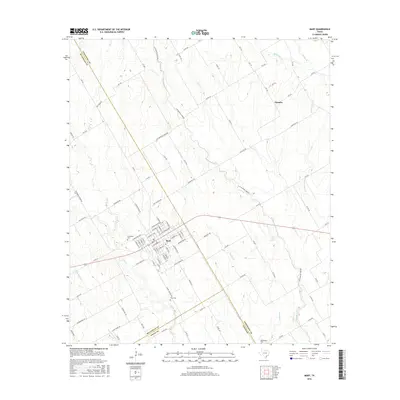
2016 Map of Mart
USGS Topo · Published 2016About this map
The city of Mart serves as the primary hub of this landscape, situated at a triple-county junction where McLennan, Limestone, and Falls counties meet. The street grid is clearly defined, following a diagonal orientation that aligns with the local drainage patterns and historic transport routes. Significant local history is preserved at Evergreen Cem on the western edge of town and Wise Cem to the south.
Find a feature on this map
99 named features on this map. Tap any name to fly to it.
Don’t see what you’re looking for? This feature index may not catch every label — zoom into the map to look around manually.
Map Details
Editions of this 2016 Mart Map
This is the sole edition of this map. No revisions or reprints were ever made.
Other maps of this area

1920 · Mart
USGS Topo · 1:62,500

1954 · Waco
USGS Topo · 1:250,000

1955 · Waco
USGS Topo · 1:250,000

1956 · Axtell
USGS Topo · 1:24,000

1956 · Mart
USGS Topo · 1:24,000

1957 · Prairie Hill
USGS Topo · 1:24,000

1957 · Groesbeck
USGS Topo · 1:62,500

1957 · Otto
USGS Topo · 1:24,000

1957 · Riesel
USGS Topo · 1:24,000
1957 · Elk
USGS Topo · 1:24,000