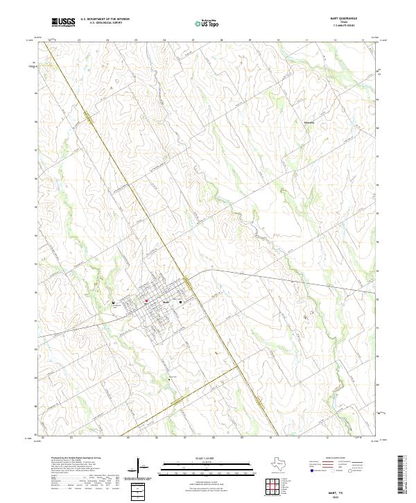
2022 Map of Mart
USGS Topo · Published 2022About this map
The city of Mart serves as the central hub of this Central Texas landscape, situated at the crossroads of McLennan, Limestone, and Falls counties. This 2022 survey captures the area's intricate drainage network, where Cottonwood Cr and Big Cr carve paths through the agricultural terrain. The map detail highlights the residential grid of Mart, extending toward the Evergreen Cem on its western edge. To the north, the small community of Victoria is positioned near the headwaters of Christmas Cr, illustrating the persistent small-town settlement patterns that define this region. Further south, the Wise Cem sits near the banks of Little Brushy Cr, offering a specific point of interest for those researching local family history or the placement of rural landmarks relative to the creek systems like Hogpen Cr.
Find a feature on this map
102 named features on this map. Tap any name to fly to it.
Don’t see what you’re looking for? This feature index may not catch every label — zoom into the map to look around manually.
Map Details
Editions of this 2022 Mart Map
This is the sole edition of this map. No revisions or reprints were ever made.
Other maps of this area

1920 · Mart
USGS Topo · 1:62,500

1954 · Waco
USGS Topo · 1:250,000

1955 · Waco
USGS Topo · 1:250,000

1956 · Axtell
USGS Topo · 1:24,000

1956 · Mart
USGS Topo · 1:24,000

1957 · Prairie Hill
USGS Topo · 1:24,000

1957 · Groesbeck
USGS Topo · 1:62,500

1957 · Otto
USGS Topo · 1:24,000

1957 · Riesel
USGS Topo · 1:24,000
1957 · Elk
USGS Topo · 1:24,000