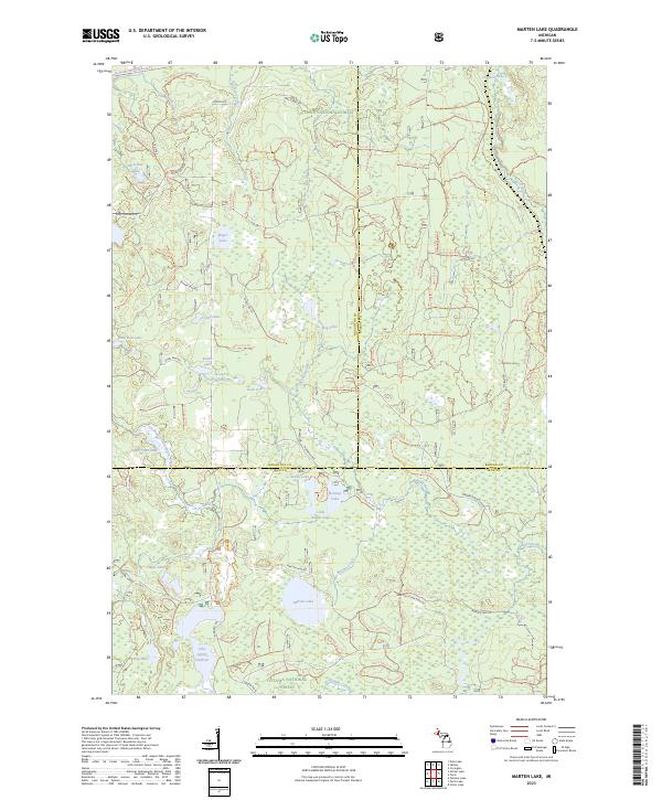
2023 Map of Marten Lake
USGS Topo · Published 2023About this map
The Ottawa National Forest dominates this section of Michigan's Upper Peninsula, where the borders of Houghton, Baraga, and Iron counties meet. The landscape is characterized by an extensive network of glacial lakes and waterways, including the protected corridor of the Ontonagon Wild and Scenic River and its East Branch. These waters once fueled the regional timber industry and now serve as a focal point for recreation and conservation.
Find a feature on this map
129 named features on this map. Tap any name to fly to it.
Don’t see what you’re looking for? This feature index may not catch every label — zoom into the map to look around manually.
Map Details
Editions of this 2023 Marten Lake Map
This is the sole edition of this map. No revisions or reprints were ever made.
Other maps of this area

1895 · Perch Lake
USGS Topo · 1:62,500

1954 · Rousseau
USGS Topo · 1:62,500

1954 · Kenton
USGS Topo · 1:62,500

1954 · Perch Lake
USGS Topo · 1:62,500

1954 · Sidnaw
USGS Topo · 1:62,500

1958 · Iron River
USGS Topo · 1:250,000

1960 · Iron River
USGS Topo · 1:250,000

1961 · Iron River
USGS Topo · 1:250,000

1967 · Iron River
USGS Topo · 1:250,000
1982 · Echo Lake
USGS Topo · 1:25,000