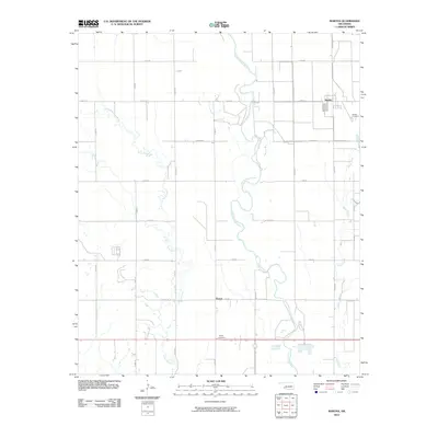
2010 Map of Martha
USGS Topo · Published 2010About this map
Martha and the rural community of Victory anchor this section of Jackson County, where the landscape is defined by the winding course of the Salt Fork Red River. The river creates a complex natural boundary as it meanders through the central corridor, flanked by tributary systems including Horse Branch to the west and Bitter Creek to the east. The map illustrates a disciplined grid of section roads, such as Grand Ave and E1630 Rd, which connect these agricultural outposts and provide access to local landmarks. Genealogy and local history researchers can identify the specific locations of Martha Cemetery and Victory Cemetery, which serve as vital reference points for families rooted in this part of Oklahoma. The spatial relationship between the river's floodplain and these upland settlements highlights the traditional patterns of development in the state's southwestern plains.
Find a feature on this map
23 named features on this map. Tap any name to fly to it.
Don’t see what you’re looking for? This feature index may not catch every label — zoom into the map to look around manually.
Map Details
Editions of this 2010 Martha Map
This is the sole edition of this map. No revisions or reprints were ever made.
Other maps of this area

1955 · Lawton
USGS Topo · 1:250,000

1963 · Altus SE
USGS Topo · 1:24,000

1964 · Martha
USGS Topo · 1:24,000

1964 · Altus
USGS Topo · 1:24,000

1964 · Olustee
USGS Topo · 1:24,000

1971 · Blair
USGS Topo · 1:24,000

1971 · Mangum South
USGS Topo · 1:24,000

1971 · Duke
USGS Topo · 1:24,000

1971 · Prairie Hill
USGS Topo · 1:24,000

1971 · Hester
USGS Topo · 1:24,000