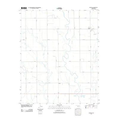
2012 Map of Martha
USGS Topo · Published 2012About this map
Martha serves as the primary settlement on this agricultural landscape, situated in the northeast near the junction of Main St and Church St. The community is anchored by the Martha Cem, while further south, the smaller settlement of Victory sits along the section lines near Victory Cem. The terrain is defined by the winding course of the Salt Fork Red River, which meanders through the central corridor of the quadrangle. This watercourse is joined by several tributaries, including Horse Br from the west and Bitter Cr to the southeast. The map reveals a strictly organized section-line road network, such as Grand Ave and various numbered rural roads, reflecting the systematic land division of Jackson County. This 2012 survey captures the persistent rural character of southwest Oklahoma, where small town centers and cemeteries remain the principal landmarks among the irrigated fields and creek bottoms.
Find a feature on this map
31 named features on this map. Tap any name to fly to it.
Don’t see what you’re looking for? This feature index may not catch every label — zoom into the map to look around manually.
Map Details
Editions of this 2012 Martha Map
This is the sole edition of this map. No revisions or reprints were ever made.
Other maps of this area

1955 · Lawton
USGS Topo · 1:250,000

1963 · Altus SE
USGS Topo · 1:24,000

1964 · Martha
USGS Topo · 1:24,000

1964 · Altus
USGS Topo · 1:24,000

1964 · Olustee
USGS Topo · 1:24,000

1971 · Blair
USGS Topo · 1:24,000

1971 · Mangum South
USGS Topo · 1:24,000

1971 · Duke
USGS Topo · 1:24,000

1971 · Prairie Hill
USGS Topo · 1:24,000

1971 · Hester
USGS Topo · 1:24,000