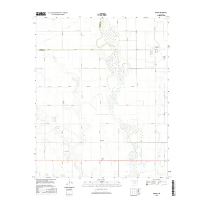
2016 Map of Martha
USGS Topo · Published 2016About this map
Salt Fork Red River dominates the central corridor of this Jackson County landscape, its wide, braided channel and surrounding wetlands creating a distinct natural boundary across the plains. To the east, the settlement of Martha sits at the intersection of Main St and Church St, serving as a localized hub for the surrounding agricultural grid. The map preserves several key sites for family history researchers, including the Martha Cem on the outskirts of town and the Victory Cem located further south near the small community of Victory. A network of rural section-line roads, such as N1980 Rd and E1630 Rd, crisscross the territory between various watercourses like Horse Br and Bitter Cr, illustrating the persistent agrarian layout of southwest Oklahoma in the early 21st century.
Find a feature on this map
35 named features on this map. Tap any name to fly to it.
Don’t see what you’re looking for? This feature index may not catch every label — zoom into the map to look around manually.
Map Details
Editions of this 2016 Martha Map
This is the sole edition of this map. No revisions or reprints were ever made.
Other maps of this area

1955 · Lawton
USGS Topo · 1:250,000

1963 · Altus SE
USGS Topo · 1:24,000

1964 · Martha
USGS Topo · 1:24,000

1964 · Altus
USGS Topo · 1:24,000

1964 · Olustee
USGS Topo · 1:24,000

1971 · Blair
USGS Topo · 1:24,000

1971 · Mangum South
USGS Topo · 1:24,000

1971 · Duke
USGS Topo · 1:24,000

1971 · Prairie Hill
USGS Topo · 1:24,000

1971 · Hester
USGS Topo · 1:24,000