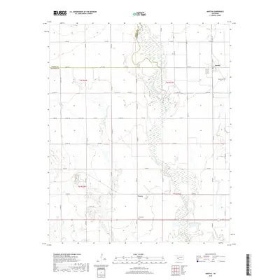
2018 Map of Martha
USGS Topo · Published 2018About this map
The Salt Fork Red River creates a wide, meandering corridor through this section of Jackson County, its braided channels and wetlands forming a distinct natural divide between the agricultural plains. In the northeast, the town of Martha serves as a local hub, featuring a Po and the Martha Cem located just outside the residential core. The landscape is defined by a strict section-line road grid, including Grand Ave and Church St, which navigate around the intermittent waterways of Horse Br and Bitter Cr.
Find a feature on this map
41 named features on this map. Tap any name to fly to it.
Don’t see what you’re looking for? This feature index may not catch every label — zoom into the map to look around manually.
Map Details
Editions of this 2018 Martha Map
This is the sole edition of this map. No revisions or reprints were ever made.
Other maps of this area

1955 · Lawton
USGS Topo · 1:250,000

1963 · Altus SE
USGS Topo · 1:24,000

1964 · Martha
USGS Topo · 1:24,000

1964 · Altus
USGS Topo · 1:24,000

1964 · Olustee
USGS Topo · 1:24,000

1971 · Blair
USGS Topo · 1:24,000

1971 · Mangum South
USGS Topo · 1:24,000

1971 · Duke
USGS Topo · 1:24,000

1971 · Prairie Hill
USGS Topo · 1:24,000

1971 · Hester
USGS Topo · 1:24,000