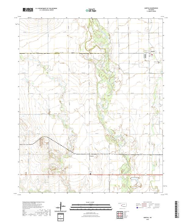
2022 Map of Martha
USGS Topo · Published 2022About this map
The braided channels of the Salt Fork Red River dominate this section of southwestern Oklahoma, carving a wide path through the agricultural landscape of Jackson and Greer counties. The small community of Martha anchors the northeast, where the local street grid centers on Church St and Main St. Outside the town center, the terrain is defined by a dense network of sectional roads and the meandering courses of Horse Br and Bitter Cr. Genealogists and local historians will find the exact locations of the Martha Cem and the Victory Cem, the latter of which serves the small settlement of Victory further south. The map illustrates a landscape primarily shaped by modern rural development, with large-scale water management and irrigation features visible along the river's broad floodplains.
Find a feature on this map
27 named features on this map. Tap any name to fly to it.
Don’t see what you’re looking for? This feature index may not catch every label — zoom into the map to look around manually.
Map Details
Editions of this 2022 Martha Map
This is the sole edition of this map. No revisions or reprints were ever made.
Other maps of this area

1955 · Lawton
USGS Topo · 1:250,000

1963 · Altus SE
USGS Topo · 1:24,000

1964 · Martha
USGS Topo · 1:24,000

1964 · Altus
USGS Topo · 1:24,000

1964 · Olustee
USGS Topo · 1:24,000

1971 · Blair
USGS Topo · 1:24,000

1971 · Mangum South
USGS Topo · 1:24,000

1971 · Duke
USGS Topo · 1:24,000

1971 · Prairie Hill
USGS Topo · 1:24,000

1971 · Hester
USGS Topo · 1:24,000