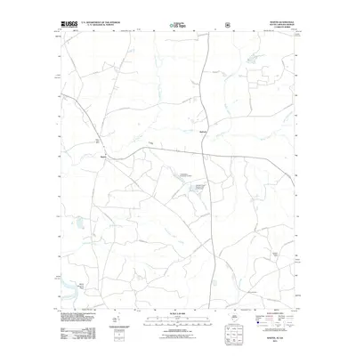
2011 Map of Martin
USGS Topo · Published 2011About this map
Martin and Baldock anchor this lowcountry landscape along the eastern bank of the Savannah River in South Carolina. The terrain is defined by an intricate network of waterways, including the winding Lower Three Runs and several smaller tributaries like Smith Lake Creek and Miller Creek. Human modification of the drainage is evident in structures such as the Catawba Pond Number One D-2574 Dam and Culbertsons Pond Dam. A distinctive landmark on the western edge is White Womans Point, situated near where the river meets the floodplains.
Find a feature on this map
43 named features on this map. Tap any name to fly to it.
Don’t see what you’re looking for? This feature index may not catch every label — zoom into the map to look around manually.
Map Details
Editions of this 2011 Martin Map
This is the sole edition of this map. No revisions or reprints were ever made.
Other maps of this area

1919 · Allendale
USGS Topo · 1:62,500

1920 · Ellenton
USGS Topo · 1:48,000

1920 · Hilltonia
USGS Topo · 1:62,500

1920 · Peeples
USGS Topo · 1:62,500

1921 · Ellenton
USGS Topo · 1:62,500

1943 · Allendale
USGS Topo · 1:62,500

1943 · Hilltonia
USGS Topo · 1:62,500

1943 · Peeples
USGS Topo · 1:62,500

1943 · Augusta East
USGS Topo · 1:125,000

1943 · Millen
USGS Topo · 1:125,000