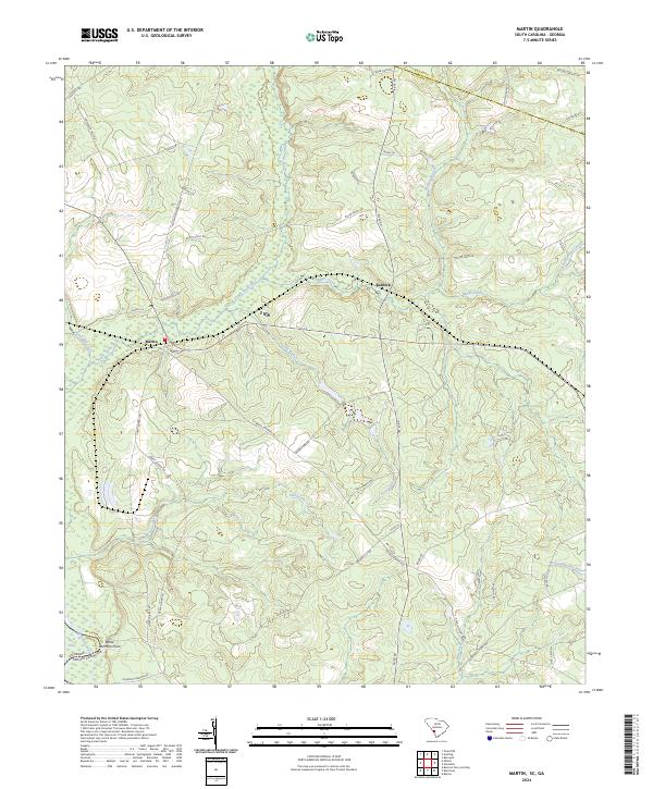
2024 Map of Martin
USGS Topo · Published 2024About this map
Lower Three Runs and its associated wetlands dominate this portion of the coastal plain near the Georgia-South Carolina border. Small rural communities like Martin and Baldock serve as focal points in a landscape primarily defined by its drainage networks and agricultural roads. The presence of Revolutionary Trl and Revolutionary Rd suggests deep local connections to early American history, while names like White Womans Point near Red Lake indicate long-standing topographical landmarks. The terrain is a complex of creek systems, including Miller Creek and Fiddle Pond Creek, which eventually feed toward the Coosawhatchie River in the southeast. This contemporary survey by the U.S. Geological Survey details the modern road network, from local routes like Washington Badger Rd to state highways, alongside the enduring natural boundaries of the Barnwell and Allendale county line.
Find a feature on this map
52 named features on this map. Tap any name to fly to it.
Don’t see what you’re looking for? This feature index may not catch every label — zoom into the map to look around manually.
Map Details
Editions of this 2024 Martin Map
This is the sole edition of this map. No revisions or reprints were ever made.
Other maps of this area

1919 · Allendale
USGS Topo · 1:62,500

1920 · Ellenton
USGS Topo · 1:48,000

1920 · Hilltonia
USGS Topo · 1:62,500

1920 · Peeples
USGS Topo · 1:62,500

1921 · Ellenton
USGS Topo · 1:62,500

1943 · Allendale
USGS Topo · 1:62,500

1943 · Hilltonia
USGS Topo · 1:62,500

1943 · Peeples
USGS Topo · 1:62,500

1943 · Augusta East
USGS Topo · 1:125,000

1943 · Millen
USGS Topo · 1:125,000