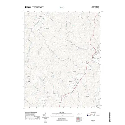
2019 Map of Martin
USGS Topo · Published 2019About this map
Right Fork Beaver Cr and its numerous winding tributaries carve through the heart of Floyd County, shaping a landscape defined by narrow hollows and ridge-top cemeteries. The settlement of Martin stands as a focal point near the confluence of Beaver Creek and Right Fork Beaver Cr, while smaller communities like Eastern, Maytown, and Warco follow the valley floors. Genealogists will find a high density of family burial grounds, including Pitts Cem, Ratliff Cem, and Atkins Cem, often situated on the high ground overlooking the creek forks. The area's infrastructure is closely tied to the terrain, with routes like Quillen Shepherd Rd and Stephens Branch Rd navigating the tight corridors. This survey provides a clear view of the eastern Kentucky coalfield's modern settlement patterns, where residential clusters like Three Oak Sub-Div sit alongside established locations such as Hippo and Pyramid.
Find a feature on this map
128 named features on this map. Tap any name to fly to it.
Don’t see what you’re looking for? This feature index may not catch every label — zoom into the map to look around manually.
Map Details
Editions of this 2019 Martin Map
This is the sole edition of this map. No revisions or reprints were ever made.
Other maps of this area

1886 · Prestonsburg
USGS Topo · 1:125,000

1890 · Whitesburg
USGS Topo · 1:125,000

1892 · Whitesburg
USGS Topo · 1:125,000

1892 · Prestonsburg
USGS Topo · 1:125,000

1912 · Hindman
USGS Topo · 1:48,000

1914 · Laynesville
USGS Topo · 1:48,000

1914 · Vergie
USGS Topo · 1:48,000

1915 · Prestonsburg
USGS Topo · 1:62,500

1915 · Hindman
USGS Topo · 1:62,500

1916 · Harold
USGS Topo · 1:62,500