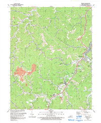
1992 Map of Martin
USGS Topo · Published 1992About this map
The CSX rail line threads through the heart of the Kentucky coalfields in this 1992 revision, connecting established company towns and rural stations. The map details the intensive industrial landscape of the region, featuring a significant Strip Mine and numerous smaller Mine sites and Mine Dump locations scattered among the hollows. Distinctive local hubs like Martin, Langley, and Eastern appear alongside smaller stops such as Samson and Buckeye, reflecting a settlement pattern defined by the narrow valleys of the Right Fork and Beaver Creek. Education and community life are represented by Allen Central High School and several rural churches like Cold Springs Ch, while family histories are preserved in various Cem sites. The terrain is deeply carved by an intricate network of waterways including Pitts Fork and Alum Cave Fork, where industrial infrastructure like a Compressor Station and Pipeline corridor sit adjacent to residential clusters.
Find a feature on this map
87 named features on this map. Tap any name to fly to it.
Don’t see what you’re looking for? This feature index may not catch every label — zoom into the map to look around manually.
Map Details
Editions of this 1992 Martin Map
This is the sole edition of this map. No revisions or reprints were ever made.
Other maps of this area

1886 · Prestonsburg
USGS Topo · 1:125,000

1890 · Whitesburg
USGS Topo · 1:125,000

1892 · Whitesburg
USGS Topo · 1:125,000

1892 · Prestonsburg
USGS Topo · 1:125,000

1912 · Hindman
USGS Topo · 1:48,000

1914 · Laynesville
USGS Topo · 1:48,000

1914 · Vergie
USGS Topo · 1:48,000

1915 · Prestonsburg
USGS Topo · 1:62,500

1915 · Hindman
USGS Topo · 1:62,500

1916 · Harold
USGS Topo · 1:62,500