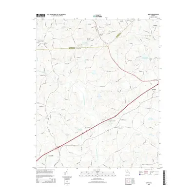
2014 Map of Martin
USGS Topo · Published 2014About this map
The Stephens Co Franklin Co line bisects this portion of Georgia, where the towns of Martin and Avalon sit at the center of a dense network of local roads like Avalon Rd and N Red Hollow Rd. This landscape is defined by the numerous headwater reservoirs and tributaries that feed the North Fork Broad River, including Reservoir 32, Reservoir 33, and the Lavonia Water Works Lake. The settlement pattern follows the ridgelines and valley floors, from the community of Toms Creek in the northwest to the edge of Lavonia in the east. Local history and genealogy are anchored by several burial grounds, such as Martin Community Cem and Franklin Memorial Cem, while the Broad River Air Park near Fairview indicates the modern infrastructure integrated into this rural corridor. The intricate system of named creeks like Unawatti Cr and Gum Log Cr highlights the region's complex drainage pattern and historical reliance on its water resources.
Find a feature on this map
143 named features on this map. Tap any name to fly to it.
Don’t see what you’re looking for? This feature index may not catch every label — zoom into the map to look around manually.
Map Details
Editions of this 2014 Martin Map
This is the sole edition of this map. No revisions or reprints were ever made.
Other maps of this area

1886 · Walhalla
USGS Topo · 1:125,000

1891 · Carnesville
USGS Topo · 1:125,000

1892 · Walhalla
USGS Topo · 1:125,000

1896 · Walhalla
USGS Topo · 1:125,000

1954 · Greenville
USGS Topo · 1:250,000

1958 · Greenville
USGS Topo · 1:250,000

1959 · Carnesville
USGS Topo · 1:24,000

1959 · Lavonia
USGS Topo · 1:24,000

1959 · Royston
USGS Topo · 1:24,000

1960 · Martin
USGS Topo · 1:24,000