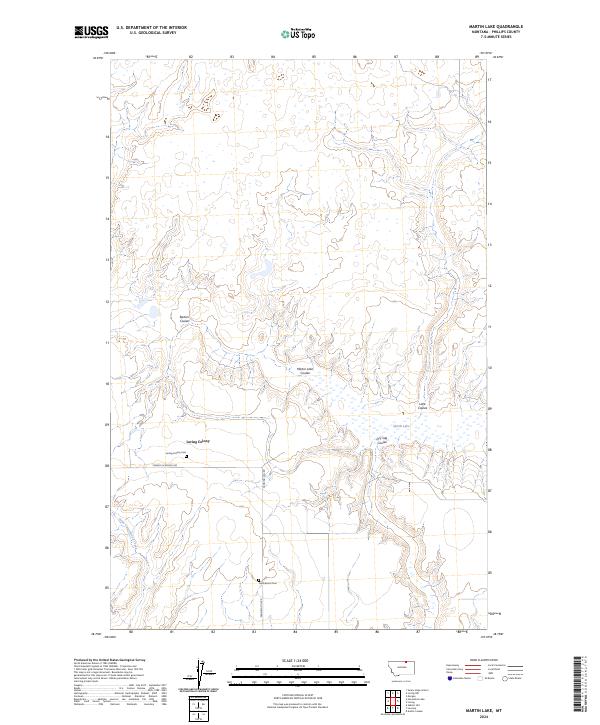
2024 Map of Martin Lake
USGS Topo · Published 2024About this map
Loring Colony serves as a central point of human settlement within this Phillips County landscape, characterized by a series of distinct drainage patterns and water bodies. The geography is defined by numerous coulees, including Barton Coulee, Martin Lake Coulee, and Lake Coulee, which channel moisture across the terrain toward Martin Lake and Little Cottonwood Creek. For researchers and family historians, the presence of the Loring Colony Cem and the more isolated Hermanson Cem offers specific points of genealogical interest. Local transport is represented by the intersection of rural routes such as Turner Cutacross Rd and Fanning Hill Rd, which traverse the open country between the established colony and the surrounding agricultural sections.
Find a feature on this map
15 named features on this map. Tap any name to fly to it.
Don’t see what you’re looking for? This feature index may not catch every label — zoom into the map to look around manually.
Map Details
Editions of this 2024 Martin Lake Map
This is the sole edition of this map. No revisions or reprints were ever made.
Other maps of this area

1920 · Avery
USGS Topo · 1:125,000

1920 · Cowan
USGS Topo · 1:125,000

1953 · Havre
USGS Topo · 1:250,000

1954 · Glasgow
USGS Topo · 1:250,000

1957 · Glasgow
USGS Topo · 1:250,000

1957 · Havre
USGS Topo · 1:250,000

1958 · Glasgow
USGS Topo · 1:250,000

1958 · Havre
USGS Topo · 1:250,000

1984 · Austin Coulee
USGS Topo · 1:24,000

1984 · Morgan
USGS Topo · 1:24,000