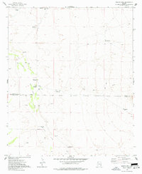
1974 Map of Martin Well
USGS Topo · Published 1977About this map
The San Simon River corridor in the mid-1970s reveals a landscape defined by its critical water sources along the Graham and Cochise County line. This arid region relied heavily on artesian and flowing wells for livestock and small-scale operations, as seen at the Martin Well and Howard Well. The presence of labels like Chaney Place and Rabbit Farm points to individual homesteading and specialized agricultural efforts in an area otherwise dominated by alluvial features like The Fan. Geologic interest is marked by several mines and prospects located west of the river. The map also records numerous corrals and a network of jeep trails that connect these remote water points, illustrating the infrastructure required for ranching in the high desert of southeastern Arizona.
Find a feature on this map
20 named features on this map. Tap any name to fly to it.
Don’t see what you’re looking for? This feature index may not catch every label — zoom into the map to look around manually.
Map Details
Editions of this 1974 Martin Well Map
This is the sole edition of this map. No revisions or reprints were ever made.
Other maps of this area

1917 · San Simon
USGS Topo · 1:125,000

1926 · Orange Butte
USGS Topo · 1:62,500

1928 · Bowie
USGS Topo · 1:62,500

1949 · Bowie
USGS Topo · 1:62,500

1950 · San Simon
USGS Topo · 1:62,500

1950 · Bowie
USGS Topo · 1:62,500

1951 · San Simon
USGS Topo · 1:62,500

1954 · Silver City
USGS Topo · 1:250,000

1958 · Silver City
USGS Topo · 1:250,000

1960 · Duncan
USGS Topo · 1:62,500