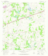
1967 Map of Martinez
USGS Topo · Published 1975About this map
Martinez and the surrounding Bexar County landscape are defined by a complex network of flood control structures along Martinez Creek and its tributaries. This 1967 survey, updated through 1973, reveals a rural area undergoing transition, where traditional homesteads and family cemeteries like Kempin Cem and Salem Cem sit alongside emerging infrastructure. The presence of numerous detention reservoirs, such as Martinez Creek Dam No 1 and Calaveras Creek Dam No 6, illustrates the mid-century effort to manage the watershed south of the city.
Find a feature on this map
44 named features on this map. Tap any name to fly to it.
Don’t see what you’re looking for? This feature index may not catch every label — zoom into the map to look around manually.
Map Details
Editions of this 1967 Martinez Map
2 editions found

Other maps of this area

1927 · New Braunfels
USGS Topo · 1:62,500

1953 · Schertz
USGS Topo · 1:24,000

1953 · San Antonio East
USGS Topo · 1:24,000

1953 · Longhorn
USGS Topo · 1:24,000

1953 · Elmendorf
USGS Topo · 1:24,000

1953 · Southton
USGS Topo · 1:24,000

1953 · Martinez
USGS Topo · 1:24,000

1954 · San Antonio
USGS Topo · 1:250,000

1957 · San Antonio
USGS Topo · 1:250,000

1958 · Marion
USGS Topo · 1:24,000