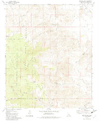
1981 Map of Martinez Mtn
USGS Topo · Published 1982About this map
Martinez Mountain dominates this desert landscape, where the high elevations of the San Bernardino National Forest transition into the arid expanse of the Coachella Valley. Much of the central terrain is designated as a State Game Refuge, highlighting the conservation priorities of the early 1980s. A network of seasonal drainages including Guadalupe Creek, Devil Canyon, and Agua Alta Canyon cut through the slopes, leading toward the vital water infrastructure of the Coachella Canal and its associated Aqueduct in the northeast. Human activity is largely represented by backcountry routes like the Cactus Spring Trail and scattered water sources such as Martinez Spring and Tanquitz Spring. These springs and the high plateau of Pinyon Alta Flat provide critical points of interest for those tracking the remote geographic landmarks of the Santa Rosa Range before modern development encroached on the valley floor.
Find a feature on this map
29 named features on this map. Tap any name to fly to it.
Don’t see what you’re looking for? This feature index may not catch every label — zoom into the map to look around manually.
Map Details
Editions of this 1981 Martinez Mtn Map
2 editions found
Other maps of this area

1904 · Indio
USGS Topo · 1:125,000

1931 · Vallecito
USGS Topo · 1:125,000

1941 · Toro Peak
USGS Topo · 1:62,500

1941 · Clark Lake
USGS Topo · 1:62,500

1941 · Coachella
USGS Topo · 1:62,500

1942 · Agua Dulce
USGS Topo · 1:62,500

1942 · Clark Lake
USGS Topo · 1:62,500

1943 · Vallecito
USGS Topo · 1:125,000

1943 · Coachella
USGS Topo · 1:62,500

1944 · Agua Dulce
USGS Topo · 1:62,500