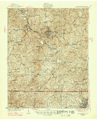
1927 Map of Martinsville
USGS Topo · Published 1947About this map
Smith River and the branching tracks of the Norfolk and Western and Danville and Western railroads anchor this study of Henry County during the mid-1920s. The industrial development at Fieldale and the regional hub of Martinsville contrast with the dense network of rural infrastructure found throughout the surrounding hills. This landscape is remarkably saturated with neighborhood institutions, from the Rough and Ready Mill on Smith River to dozens of community schools such as Lenier Farm School and Leatherwood School.
Find a feature on this map
105 named features on this map. Tap any name to fly to it.
Don’t see what you’re looking for? This feature index may not catch every label — zoom into the map to look around manually.
Map Details
Editions of this 1927 Martinsville Map
2 editions found
Other maps of this area

1922 · Callands
USGS Topo · 1:48,000

1924 · Martinsville
USGS Topo · 1:48,000

1924 · Draper
USGS Topo · 1:48,000

1924 · Callands
USGS Topo · 1:62,500

1925 · Rocky Mount
USGS Topo · 1:48,000

1926 · Martinsville
USGS Topo · 1:62,500

1926 · Critz
USGS Topo · 1:48,000

1926 · Draper
USGS Topo · 1:62,500

1927 · Rocky Mount
USGS Topo · 1:62,500

1927 · Martinsville
USGS Topo · 1:62,500