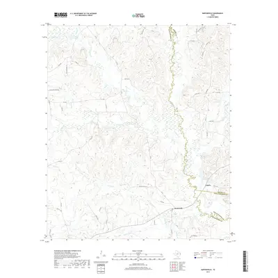
2019 Map of Martinsville
USGS Topo · Published 2019About this map
Martinsville sits as a central settlement in this East Texas landscape where the boundaries of Nacogdoches, Shelby, and San Augustine counties converge. The terrain is defined by an intricate network of waterways, most notably the meandering Attoyac River and the substantial Naconiche Cr. These streams, along with smaller tributaries like Terrapin Cr and Waffelow Cr, carved the rolling topography and likely influenced the early road patterns that now form the network of farm-to-market and county routes.
Find a feature on this map
52 named features on this map. Tap any name to fly to it.
Don’t see what you’re looking for? This feature index may not catch every label — zoom into the map to look around manually.
Map Details
Editions of this 2019 Martinsville Map
This is the sole edition of this map. No revisions or reprints were ever made.
Other maps of this area

1952 · Nacogdoches
USGS Topo · 1:62,500

1953 · Palestine
USGS Topo · 1:250,000

1957 · Palestine
USGS Topo · 1:250,000

1958 · Martinsville
USGS Topo · 1:62,500

1958 · Timpson
USGS Topo · 1:62,500

1960 · Mount Enterprise
USGS Topo · 1:62,500
1983 · Woden
USGS Topo · 1:24,000
1983 · Appleby
USGS Topo · 1:24,000

1984 · Palestine
USGS Topo · 1:250,000
1984 · Chireno North
USGS Topo · 1:24,000