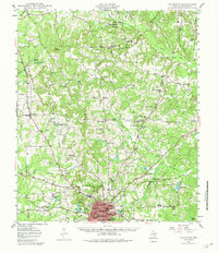
1984 Map of Palestine
USGS Topo · Published 1984About this map
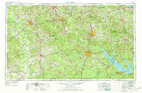
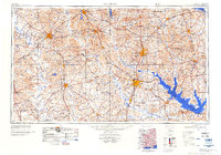
The Davy Crockett National Forest and Angelina National Forest dominate the East Texas landscape in this mid-1980s revision, showcasing a region defined by its timberlands and massive water projects. Large reservoirs like Sam Rayburn Lake and the Toledo Bend Reservoir on the Sabine River are prominent, reflecting the 20th-century transformation of the local hydrology for flood control and recreation. The rail-and-road network connects established centers like Palestine, Lufkin, and Nacogdoches, with the Missouri Pacific RR and Southern Pacific RR lines still tracing their historic paths through the piney woods.
Find a feature on this map
204 named features on this map. Tap any name to fly to it.
Don’t see what you’re looking for? This feature index may not catch every label — zoom into the map to look around manually.
Map Details
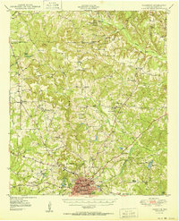
Editions of this 1984 Palestine Map
3 editions found
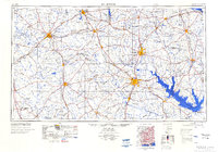
Historical Maps of Lufkin Through Time
6 maps found