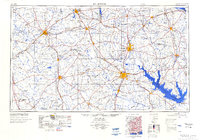
1984 Map of Palestine
USGS Topo · Published 1984About this map
Palestine and Nacogdoches serve as the principal hubs in this mid-1970s look at East Texas, where the transition from dense piney woods to river bottomlands defines the landscape. The region is heavily marked by the timber and oil industries, with extensive tracts like the Davy Crockett National Forest and Sabine National Forest broken by scattered Oil Field operations and Gas Wells. Water management is a dominant feature of this era, evidenced by the massive footprints of the Sam Rayburn Reservoir and Toledo Bend Reservoir along the eastern edge, which altered the original flow of the Angelina River and Sabine River.
Find a feature on this map
234 named features on this map. Tap any name to fly to it.
Don’t see what you’re looking for? This feature index may not catch every label — zoom into the map to look around manually.
Map Details
Editions of this 1984 Palestine Map
3 editions found

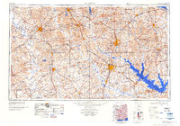
Other maps of this area

1919 · Fairfield
USGS Topo · 1:62,500

1927 · Lufkin 4-c
USGS Topo · 1:24,000

1928 · Zavalla 3-c
USGS Topo · 1:24,000

1928 · Lufkin 4-d
USGS Topo · 1:24,000

1931 · Zavalla
USGS Topo · 1:62,500

1931 · Iola
USGS Topo · 1:62,500

1932 · Manning
USGS Topo · 1:62,500

1935 · Henderson
USGS Topo · 1:48,000

1937 · Troupe
USGS Topo · 1:48,000

1939 · Henderson
USGS Topo · 1:62,500