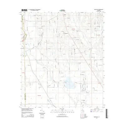
2015 Map of Martinville
USGS Topo · Published 2015About this map
The Tchefuncte River and its numerous tributaries, such as Soap and Tallow Br and Calvpen Br, define the landscape of St. Tammany Parish on the outskirts of Covington. This 2015 survey reveals a blend of rural settlement and residential growth, centered around the village of Martinville and the southern edge of Folsom. The area is notably dense with small family and community burial grounds, including the Saint Johns Cem, Fendlason Cem, and Willie Cem, providing essential markers for genealogical research in this part of Louisiana. Transportation and commerce are reflected in the presence of the Covington-Vincent Airport to the south and a network of winding parish roads. Significant water features like Lake Ramsay and Spell Pond highlight the low-lying, well-watered geography between the Tchefuncte and the Bogue Falaya river systems.
Find a feature on this map
149 named features on this map. Tap any name to fly to it.
Don’t see what you’re looking for? This feature index may not catch every label — zoom into the map to look around manually.
Map Details
Editions of this 2015 Martinville Map
This is the sole edition of this map. No revisions or reprints were ever made.
Other maps of this area

1935 · Covington
USGS Topo · 1:62,500

1935 · Ponchatoula
USGS Topo · 1:62,500

1939 · Ponchatoula
USGS Topo · 1:62,500

1939 · Zona
USGS Topo · 1:31,680

1939 · Covington
USGS Topo · 1:62,500

1942 · Onville
USGS Topo · 1:31,680

1942 · Waldheim
USGS Topo · 1:31,680

1942 · Husser
USGS Topo · 1:31,680

1942 · Robert
USGS Topo · 1:31,680

1950 · Folsom
USGS Topo · 1:31,680