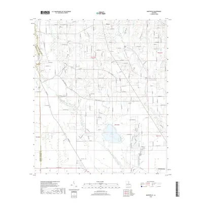
2018 Map of Martinville
USGS Topo · Published 2018About this map
The Tchefuncte River and its numerous tributaries, such as Savannah Br and Bogue Falaya, define the wet, low-lying landscape of St. Tammany Parish on the northern outskirts of Covington. This 2018 survey reveals a mosaic of pine-heavy lowlands and small-scale developments, particularly around the northern settlement of Folsom and the central area of Martinville. The region is notably dense with small family cemeteries, suggesting a deep-rooted genealogical history; burial sites like Saint Johns Cem, Fendlasen Cem, and Willie Cem are scattered across the township lines. Toward the south, the terrain opens into the basin of Lake Ramsay, while aviation infrastructure is represented by the Covington-Vincent Airport. The map also captures the intricate network of local drainage, including Simalusa Creek and Horse Br, which feed the larger river systems of the Florida Parishes.
Find a feature on this map
156 named features on this map. Tap any name to fly to it.
Don’t see what you’re looking for? This feature index may not catch every label — zoom into the map to look around manually.
Map Details
Editions of this 2018 Martinville Map
This is the sole edition of this map. No revisions or reprints were ever made.
Other maps of this area

1935 · Covington
USGS Topo · 1:62,500

1935 · Ponchatoula
USGS Topo · 1:62,500

1939 · Ponchatoula
USGS Topo · 1:62,500

1939 · Zona
USGS Topo · 1:31,680

1939 · Covington
USGS Topo · 1:62,500

1942 · Onville
USGS Topo · 1:31,680

1942 · Waldheim
USGS Topo · 1:31,680

1942 · Husser
USGS Topo · 1:31,680

1942 · Robert
USGS Topo · 1:31,680

1950 · Folsom
USGS Topo · 1:31,680