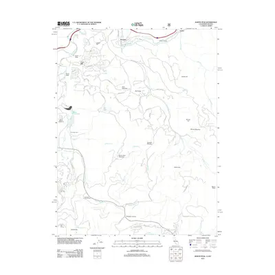
2012 Map of Martis Peak
USGS Topo · Published 2012About this map
Martis Peak stands as the high point of this Sierra Nevada landscape, overlooking a complex network of alpine meadows and watercourses near the California-Nevada border. The map reveals a transition from the industrial legacy of Union Mills and Hirschdale along the Truckee River to the modern recreation economy centered on the Northstar-at-Tahoe Ski Area. Numerous mountain tributaries, including Middle Martis Cr and Monte Carlo Cr, feed into Martis Creek Lake, while historical sites like the Old Joerger Ranch suggest the area's earlier agricultural and ranching history. The topography is defined by high ridges like Buck Ridge and open flats such as Sawmill Flat, intersected by a modern road network including Glenshire Dr and Martis Peak Rd.
Find a feature on this map
63 named features on this map. Tap any name to fly to it.
Don’t see what you’re looking for? This feature index may not catch every label — zoom into the map to look around manually.
Map Details
Editions of this 2012 Martis Peak Map
This is the sole edition of this map. No revisions or reprints were ever made.
Other maps of this area

1891 · Carson
USGS Topo · 1:125,000

1891 · Truckee
USGS Topo · 1:125,000

1893 · Carson
USGS Topo · 1:125,000

1893 · Truckee
USGS Topo · 1:125,000

1895 · Truckee
USGS Topo · 1:125,000

1932 · Truckee
USGS Topo · 1:96,000

1940 · Truckee
USGS Topo · 1:125,000

1950 · Mt. Rose
USGS Topo · 1:62,500

1952 · Mt. Rose
USGS Topo · 1:62,500

1955 · Truckee
USGS Topo · 1:24,000