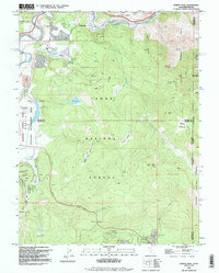
1992 Map of Martis Peak
USGS Topo · Published 1994About this map
Tahoe National Forest and the Mount Rose Wilderness converge in this high-altitude landscape along the California-Nevada border. This area showcases the transition from industrial history to modern recreation, centered around the Martis Creek Lake and the developing Northstar-at-Tahoe resort. Local history is etched into the terrain at the Union Mills (Site) and along the Truckee River corridor near Hirschdale.
Find a feature on this map
49 named features on this map. Tap any name to fly to it.
Don’t see what you’re looking for? This feature index may not catch every label — zoom into the map to look around manually.
Map Details
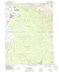
Editions of this 1992 Martis Peak Map
2 editions found
Other maps of this area

1891 · Carson
USGS Topo · 1:125,000

1891 · Truckee
USGS Topo · 1:125,000

1893 · Carson
USGS Topo · 1:125,000

1893 · Truckee
USGS Topo · 1:125,000

1895 · Truckee
USGS Topo · 1:125,000

1932 · Truckee
USGS Topo · 1:96,000

1940 · Truckee
USGS Topo · 1:125,000

1950 · Mt. Rose
USGS Topo · 1:62,500

1952 · Mt. Rose
USGS Topo · 1:62,500

1955 · Truckee
USGS Topo · 1:24,000