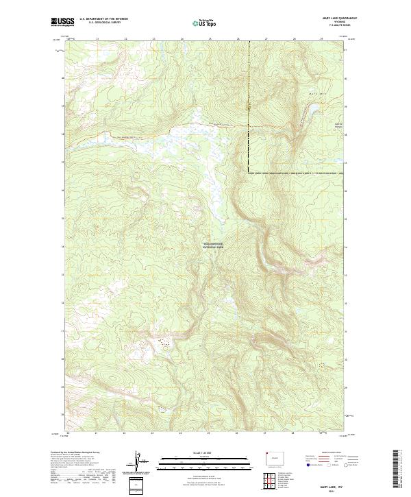
2021 Map of Mary Lake
USGS Topo · Published 2021About this map
Mary Lake sits high on the Central Plateau in this recent survey of a protected wilderness interior. This portion of Yellowstone National Park is defined by a complex drainage network where Nez Perce Cr and its tributaries, including Magpie Cr and Cowan Cr, carve through the volcanic landscape. The terrain is marked by significant elevation changes, rising toward the summit of Mary Mtn in the northeast. Human passage is limited to the Mary Mountain-Nez Perce Trl, which provides a single east-west corridor across the northern half of the map. To the south, the headwaters of Juniper Cr and White Cr flow through a more isolated backcountry, illustrating the undisturbed hydrography of the Teton and Park county border region.
Find a feature on this map
18 named features on this map. Tap any name to fly to it.
Don’t see what you’re looking for? This feature index may not catch every label — zoom into the map to look around manually.
Map Details
Editions of this 2021 Mary Lake Map
This is the sole edition of this map. No revisions or reprints were ever made.
Other maps of this area

1885 · Gallatin
USGS Topo · 1:125,000

1885 · Gallatin
USGS Topo · 1:125,000

1886 · Shoshone
USGS Topo · 1:125,000

1888 · Shoshone
USGS Topo · 1:125,000

1895 · Shoshone
USGS Topo · 1:125,000

1901 · Shoshone
USGS Topo · 1:125,000

1901 · Gallatin
USGS Topo · 1:125,000

1908 · Gallatin
USGS Topo · 1:125,000

1908 · Shoshone
USGS Topo · 1:125,000

1911 · Shoshone
USGS Topo · 1:125,000