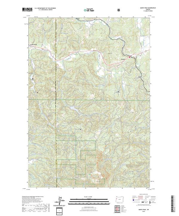
2023 Map of Marys Peak
USGS Topo · Published 2023About this map
Marys Peak stands as the dominant topographical feature in this section of the Oregon Coast Range, marking the transition between Siuslaw National Forest and the surrounding river valleys. The landscape is defined by a dense network of watercourses, including the Marys River, Tumtum River, and Shotpouch Creek, which carve through prominent landforms like Shroyer Ridge and Chinquapin Ridge. Small settlements such as Summit, Blodgett, and Burnt Woods are concentrated along the northern transport corridors, while the southern reaches are characterized by steep elevation changes and managed forest lands.
Find a feature on this map
58 named features on this map. Tap any name to fly to it.
Don’t see what you’re looking for? This feature index may not catch every label — zoom into the map to look around manually.
Map Details
Editions of this 2023 Marys Peak Map
This is the sole edition of this map. No revisions or reprints were ever made.
Other maps of this area

1921 · Corvallis
USGS Topo · 1:62,500

1922 · Monroe
USGS Topo · 1:62,500

1939 · Marys Peak
USGS Topo · 1:62,500

1939 · Monroe
USGS Topo · 1:62,500

1942 · Marys Peak
USGS Topo · 1:62,500

1942 · Alsea
USGS Topo · 1:62,500

1942 · Monroe
USGS Topo · 1:62,500

1942 · Corvallis
USGS Topo · 1:62,500

1953 · Salem
USGS Topo · 1:250,000

1954 · Salem
USGS Topo · 1:250,000