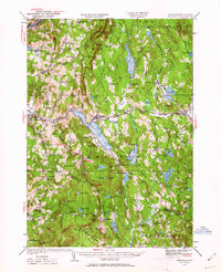
1927 Map of Mascoma
USGS Topo · Published 1962About this map
The Shaker communities of Lower Shaker Village and Upper Shaker Village anchor the western shore of Mascoma Lake, marking a landscape defined by communal settlement and religious history. This survey captures a rural New Hampshire economy transitioning toward the mid-20th century, where local travel was increasingly shaped by the Dartmouth College Highway. The Boston and Maine railroad tracks follow the winding course of the Mascoma River through Enfield and Canaan, serving as a vital industrial artery through the hills. Educational life is documented through numerous neighborhood schoolhouses, including the Arvin Sch and the remote Height of Land Sch. To the south, the topography rises toward Grantham Mtn, while the interior is dotted with numerous small bodies of water like Spectacle Pond and Goose Pond, reflecting the glaciated character of the Grafton County terrain before the arrival of modern interstate development.
Find a feature on this map
140 named features on this map. Tap any name to fly to it.
Don’t see what you’re looking for? This feature index may not catch every label — zoom into the map to look around manually.
Map Details
Editions of this 1927 Mascoma Map
3 editions found
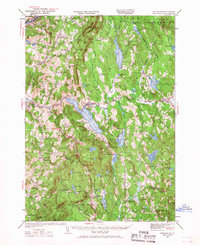
Other maps of this area

1896 · Strafford
USGS Topo · 1:62,500

1902 · Sunapee
USGS Topo · 1:62,500

1905 · Sunapee
USGS Topo · 1:62,500

1906 · Hanover
USGS Topo · 1:62,500

1907 · Sunapee
USGS Topo · 1:62,500

1908 · Hanover
USGS Topo · 1:62,500

1926 · Claremont
USGS Topo · 1:62,500

1927 · Cardigan
USGS Topo · 1:62,500

1927 · Mascoma
USGS Topo · 1:62,500

1928 · Mount Kearsarge
USGS Topo · 1:62,500