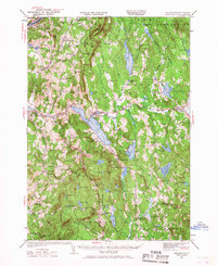
1927 Map of Mascoma
USGS Topo · Published 1968About this map
Lower Shaker Village and Upper Shaker Village sit prominently along the western shore of Mascoma Lake, marking a distinct religious and communal footprint on this New Hampshire landscape. In the late 1920s, the region was defined by a network of upland farms and small neighborhoods like Hanover Center and Goss Neighborhood, supported by numerous local schools including the Etna Highlands Sch and North Canaan Sch. The corridor of the Boston and Maine railroad follows the Mascoma River, connecting established hubs like Enfield and Canaan.
Find a feature on this map
99 named features on this map. Tap any name to fly to it.
Don’t see what you’re looking for? This feature index may not catch every label — zoom into the map to look around manually.
Map Details
Editions of this 1927 Mascoma Map
3 editions found
Other maps of this area

1896 · Strafford
USGS Topo · 1:62,500

1902 · Sunapee
USGS Topo · 1:62,500

1905 · Sunapee
USGS Topo · 1:62,500

1906 · Hanover
USGS Topo · 1:62,500

1907 · Sunapee
USGS Topo · 1:62,500

1908 · Hanover
USGS Topo · 1:62,500

1926 · Claremont
USGS Topo · 1:62,500

1927 · Cardigan
USGS Topo · 1:62,500

1927 · Mascoma
USGS Topo · 1:62,500

1928 · Mount Kearsarge
USGS Topo · 1:62,500