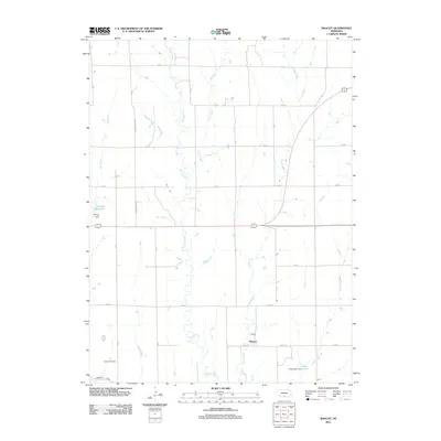
2011 Map of Mascot
USGS Topo · Published 2011About this map
The small settlement of Mascot sits as a quiet focal point in this agricultural landscape of Harlan and Furnas Counties. The terrain is defined by the dendritic drainage patterns of Spring Creek, Elm Creek, and Deep Creek, which flow southward toward the Republican River valley. This 2011 survey captures a rural environment where land management is reflected in water infrastructure, specifically through features like the Lueking Reservoir and Drake Reservoir. The Cambridge Canal skims the southwestern corner, indicating the importance of irrigation and water control to the local economy. For those researching local heritage, the Oxford Cemetery stands as a primary genealogical landmark near the western edge of the quadrangle. The grid of section roads, including Spring Grove Rd and various numbered routes like 724 Rd, organizes the vast prairie into a strictly partitioned system typical of the High Plains.
Find a feature on this map
21 named features on this map. Tap any name to fly to it.
Don’t see what you’re looking for? This feature index may not catch every label — zoom into the map to look around manually.
Map Details
Editions of this 2011 Mascot Map
This is the sole edition of this map. No revisions or reprints were ever made.
Other maps of this area

1896 · Holdrege
USGS Topo · 1:125,000

1896 · Arapahoe
USGS Topo · 1:125,000

1898 · Arapahoe
USGS Topo · 1:125,000

1955 · Grand Island
USGS Topo · 1:250,000

1957 · Grand Island
USGS Topo · 1:250,000

1958 · Grand Island
USGS Topo · 1:250,000

1958 · Hollinger
USGS Topo · 1:24,000

1958 · Stamford
USGS Topo · 1:24,000

1958 · Mascot
USGS Topo · 1:24,000
1958 · Oxford
USGS Topo · 1:24,000