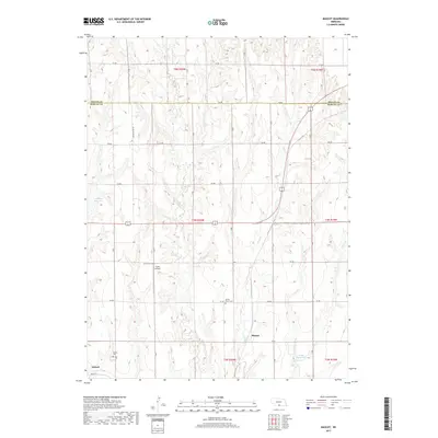
2017 Map of Mascot
USGS Topo · Published 2017About this map
Mascot and the eastern edge of Oxford anchor this rural landscape along the border of Phelps and Harlan counties. The terrain is defined by a series of south-flowing drainages including Spring Cr, Deep Cr, and Foster Cr, which carve through the agricultural uplands. Evidence of local aviation and water management is visible through Clyde Airfield and several localized catchments like Lueking Reservoir and Drake Reservoir.
Find a feature on this map
28 named features on this map. Tap any name to fly to it.
Don’t see what you’re looking for? This feature index may not catch every label — zoom into the map to look around manually.
Map Details
Editions of this 2017 Mascot Map
This is the sole edition of this map. No revisions or reprints were ever made.
Other maps of this area

1896 · Holdrege
USGS Topo · 1:125,000

1896 · Arapahoe
USGS Topo · 1:125,000

1898 · Arapahoe
USGS Topo · 1:125,000

1955 · Grand Island
USGS Topo · 1:250,000

1957 · Grand Island
USGS Topo · 1:250,000

1958 · Grand Island
USGS Topo · 1:250,000

1958 · Hollinger
USGS Topo · 1:24,000

1958 · Stamford
USGS Topo · 1:24,000

1958 · Mascot
USGS Topo · 1:24,000
1958 · Oxford
USGS Topo · 1:24,000