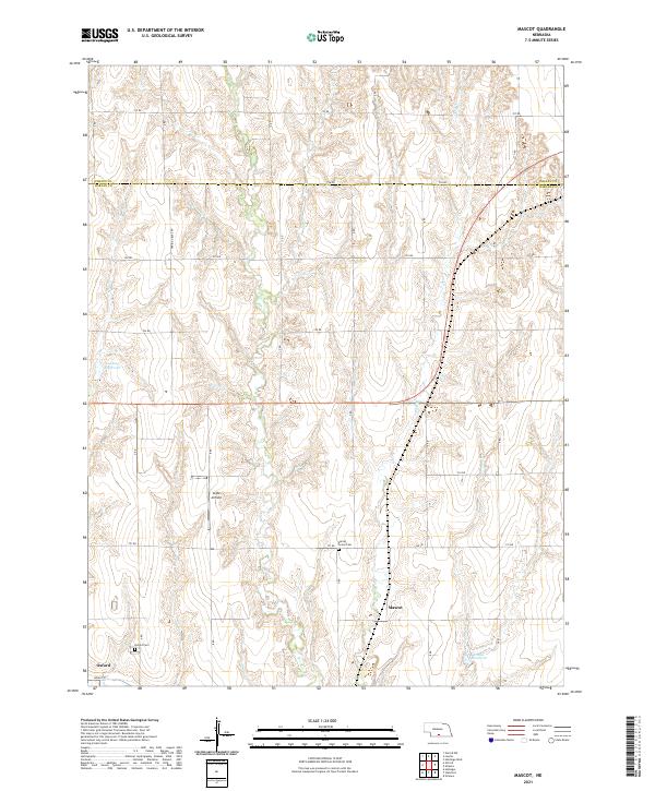
2021 Map of Mascot
USGS Topo · Published 2021About this map
Mascot and the surrounding agricultural landscape of Harlan and Phelps counties are defined by a strict section-line road grid and intermittent watercourses. This 2021 survey shows a rural environment where water management is critical, evidenced by features like Lueking Reservoir and Drake Reservoir. The settlement of Oxford sits at the southwestern edge of the sheet, served by Bright St and near the Oxford Cem.
Find a feature on this map
25 named features on this map. Tap any name to fly to it.
Don’t see what you’re looking for? This feature index may not catch every label — zoom into the map to look around manually.
Map Details
Editions of this 2021 Mascot Map
This is the sole edition of this map. No revisions or reprints were ever made.
Other maps of this area

1896 · Holdrege
USGS Topo · 1:125,000

1896 · Arapahoe
USGS Topo · 1:125,000

1898 · Arapahoe
USGS Topo · 1:125,000

1955 · Grand Island
USGS Topo · 1:250,000

1957 · Grand Island
USGS Topo · 1:250,000

1958 · Grand Island
USGS Topo · 1:250,000

1958 · Hollinger
USGS Topo · 1:24,000

1958 · Stamford
USGS Topo · 1:24,000

1958 · Mascot
USGS Topo · 1:24,000
1958 · Oxford
USGS Topo · 1:24,000