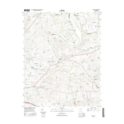
2016 Map of Mascot
USGS Topo · Published 2016About this map
The Holston River meanders through this East Tennessee landscape, defining the boundaries where Knox, Grainger, Jefferson, and Sevier counties meet. This riverine geography is punctuated by numerous shoals and islands, including McBees Shoals and Monday Island, which historically influenced the placement of early crossings and river-based industry. The settlement of Strawberry Plains serves as a central hub, surrounded by smaller communities such as Wyricktown and Mascot. High points like Bays Mountain and Edwards Knob overlook a terrain rich with ancestral markers, from the Holston View Memory Gardens to numerous family plots like the Foster Cem and McBee Cem. The layout of the roads, including Ruggles Ferry Pike and Old Rutledge Pike, reveals the established corridors of movement that have connected these ridge-and-valley communities for generations.
Find a feature on this map
204 named features on this map. Tap any name to fly to it.
Don’t see what you’re looking for? This feature index may not catch every label — zoom into the map to look around manually.
Map Details
Editions of this 2016 Mascot Map
This is the sole edition of this map. No revisions or reprints were ever made.
Other maps of this area

1886 · Knoxville
USGS Topo · 1:125,000

1892 · Knoxville
USGS Topo · 1:125,000

1894 · Knoxville
USGS Topo · 1:125,000

1895 · Knoxville
USGS Topo · 1:125,000

1897 · Maynardville
USGS Topo · 1:125,000

1900 · Maynardville
USGS Topo · 1:125,000

1901 · Knoxville
USGS Topo · 1:125,000

1935 · Luttrell
USGS Topo · 1:24,000

1935 · Mascot
USGS Topo · 1:24,000

1935 · Knoxville
USGS Topo · 1:48,000