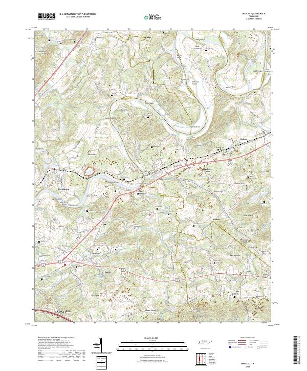
2022 Map of Mascot
USGS Topo · Published 2022About this map
The Holston River winds through this landscape, defining a series of dramatic loops and bends like Big Bend and Byerley Bend. These waters are punctuated by numerous river features, including McBees Shoals and Jarnagins Shoals, alongside significant islands such as McBee Island and Trent Island. The area shows a transition from the industrial and transport corridor near Strawberry Plains, where the Norfolk Southern railroad crosses the terrain, to more dispersed settlements and family-named landmarks.
Find a feature on this map
210 named features on this map. Tap any name to fly to it.
Don’t see what you’re looking for? This feature index may not catch every label — zoom into the map to look around manually.
Map Details
Editions of this 2022 Mascot Map
This is the sole edition of this map. No revisions or reprints were ever made.
Other maps of this area

1886 · Knoxville
USGS Topo · 1:125,000

1892 · Knoxville
USGS Topo · 1:125,000

1894 · Knoxville
USGS Topo · 1:125,000

1895 · Knoxville
USGS Topo · 1:125,000

1897 · Maynardville
USGS Topo · 1:125,000

1900 · Maynardville
USGS Topo · 1:125,000

1901 · Knoxville
USGS Topo · 1:125,000

1935 · Luttrell
USGS Topo · 1:24,000

1935 · Mascot
USGS Topo · 1:24,000

1935 · Knoxville
USGS Topo · 1:48,000