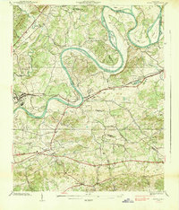
1938 Map of Mascot
USGS Topo · Published 1938About this map
The Holston River dictates the landscape of this 1938 survey, carving deep meanders like Big Bend, Lower Bend, and Sweet Gum Bend through East Tennessee. The confluence of rail and river commerce is evident as the Southern Railway parallels the Andrew Johnson Highway through the settlements of Mascot and Strawberry Plains. These transportation corridors served as the backbone for rural life, connecting localized industry like Carter Mill and Trentville to larger markets.
Find a feature on this map
80 named features on this map. Tap any name to fly to it.
Don’t see what you’re looking for? This feature index may not catch every label — zoom into the map to look around manually.
Map Details
Editions of this 1938 Mascot Map
This is the sole edition of this map. No revisions or reprints were ever made.
Other maps of this area

1886 · Knoxville
USGS Topo · 1:125,000

1892 · Knoxville
USGS Topo · 1:125,000

1894 · Knoxville
USGS Topo · 1:125,000

1895 · Knoxville
USGS Topo · 1:125,000

1897 · Maynardville
USGS Topo · 1:125,000

1900 · Maynardville
USGS Topo · 1:125,000

1901 · Knoxville
USGS Topo · 1:125,000

1935 · Luttrell
USGS Topo · 1:24,000

1935 · Mascot
USGS Topo · 1:24,000

1935 · Knoxville
USGS Topo · 1:48,000