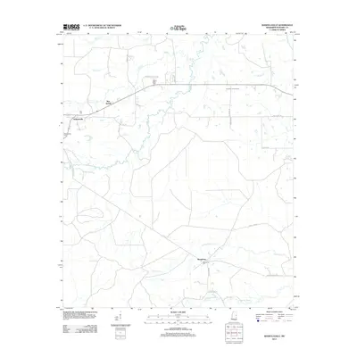
2012 Map of Mashulaville
USGS Topo · Published 2012About this map
Mashulaville and Macedonia anchor this rural landscape in Noxubee County, where small settlements and family cemeteries define the community layout. The terrain is characterized by a dense network of watercourses including the Noxubee River, Wolf Cr, and Hashuqua Cr, which likely shaped the early road patterns such as Mashulaville Shuqualak Rd. The presence of several burial grounds, such as Mount Olive Cem, May Cem, and the Macedonia Cem, provides significant points of interest for genealogists tracing family roots in this part of Mississippi.
Find a feature on this map
33 named features on this map. Tap any name to fly to it.
Don’t see what you’re looking for? This feature index may not catch every label — zoom into the map to look around manually.
Map Details
Editions of this 2012 Mashulaville Map
This is the sole edition of this map. No revisions or reprints were ever made.
Other maps of this area

1953 · Meridian
USGS Topo · 1:250,000

1953 · West Point
USGS Topo · 1:250,000

1957 · Meridian
USGS Topo · 1:250,000

1958 · West Point
USGS Topo · 1:250,000

1962 · Preston
USGS Topo · 1:24,000

1962 · Shuqualak
USGS Topo · 1:24,000

1963 · West Point
USGS Topo · 1:250,000

1963 · Gholson
USGS Topo · 1:24,000

1965 · Meridian
USGS Topo · 1:250,000
1973 · Fearns Springs
USGS Topo · 1:24,000