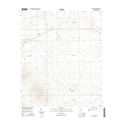
2015 Map of Mashulaville
USGS Topo · Published 2015About this map
Mashulaville and the surrounding Noxubee County landscape are defined by a complex network of waterways feeding the Noxubee River in the northeastern corner of this survey. The settlement patterns follow the higher ground between creek drainages, with the historic community of Macedonia situated in the southern reaches and May Spring positioned further north. The land is crisscrossed by numerous rural routes, including Carr Rd and Honey Lake Rd, which connect isolated homesteads and family cemeteries.
Find a feature on this map
38 named features on this map. Tap any name to fly to it.
Don’t see what you’re looking for? This feature index may not catch every label — zoom into the map to look around manually.
Map Details
Editions of this 2015 Mashulaville Map
This is the sole edition of this map. No revisions or reprints were ever made.
Other maps of this area

1953 · Meridian
USGS Topo · 1:250,000

1953 · West Point
USGS Topo · 1:250,000

1957 · Meridian
USGS Topo · 1:250,000

1958 · West Point
USGS Topo · 1:250,000

1962 · Preston
USGS Topo · 1:24,000

1962 · Shuqualak
USGS Topo · 1:24,000

1963 · West Point
USGS Topo · 1:250,000

1963 · Gholson
USGS Topo · 1:24,000

1965 · Meridian
USGS Topo · 1:250,000
1973 · Fearns Springs
USGS Topo · 1:24,000