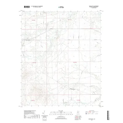
2018 Map of Mashulaville
USGS Topo · Published 2018About this map
Mashulaville and the smaller community of Macedonia define the settlement pattern of this Noxubee County landscape, characterized by a network of rural roads and family cemeteries. The terrain is deeply carved by numerous watercourses, including the north-south flow of Hashuqua Creek and the southern reaches of Macedonia Cr. Evidence of early community life is preserved through several burial grounds, such as Mount Olive Cem and May Cem, which are tucked away near the local road networks of Cline Rd and Hill Rd. The eastern edge of the map is bordered by the Noxubee River, while the southern portion is drained by Running Water Cr. The intersection of multiple townships and ranges across the quadrangle suggests a long-established rural grid that has historically supported small-scale agriculture and timber in this part of Mississippi.
Find a feature on this map
38 named features on this map. Tap any name to fly to it.
Don’t see what you’re looking for? This feature index may not catch every label — zoom into the map to look around manually.
Map Details
Editions of this 2018 Mashulaville Map
This is the sole edition of this map. No revisions or reprints were ever made.
Other maps of this area

1953 · Meridian
USGS Topo · 1:250,000

1953 · West Point
USGS Topo · 1:250,000

1957 · Meridian
USGS Topo · 1:250,000

1958 · West Point
USGS Topo · 1:250,000

1962 · Preston
USGS Topo · 1:24,000

1962 · Shuqualak
USGS Topo · 1:24,000

1963 · West Point
USGS Topo · 1:250,000

1963 · Gholson
USGS Topo · 1:24,000

1965 · Meridian
USGS Topo · 1:250,000
1973 · Fearns Springs
USGS Topo · 1:24,000