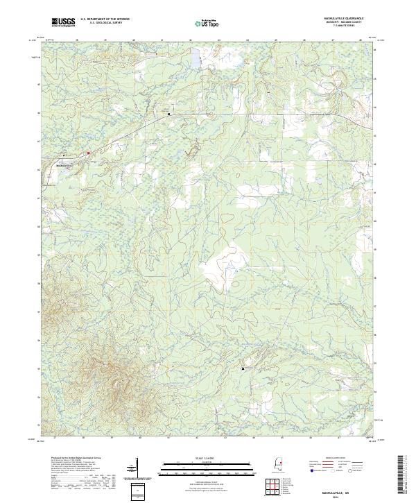
2024 Map of Mashulaville
USGS Topo · Published 2024About this map
The community of Mashulaville serves as the focal point of this Noxubee County landscape, where the headwaters of several drainages define the local topography. This region is marked by a network of rural routes such as Hill Rd and Macedonia Rd, connecting scattered homesteads and generational landmarks. The terrain is deeply carved by water, with Sun Creek and Wolf Creek flowing through the northern reaches while Running Water Creek and Macedonia Creek dominate the south. Genealogists will find significant value in the preservation of several local burial sites, including the Mashulaville Cem, Mount Olive Cem, and Macedonia Cem. To the northeast, the Noxubee River and Poplar Creek cross the corner of the survey, illustrating the complex hydrography of the East Mississippi piney woods and agricultural borderlands.
Find a feature on this map
38 named features on this map. Tap any name to fly to it.
Don’t see what you’re looking for? This feature index may not catch every label — zoom into the map to look around manually.
Map Details
Editions of this 2024 Mashulaville Map
This is the sole edition of this map. No revisions or reprints were ever made.
Other maps of this area

1953 · Meridian
USGS Topo · 1:250,000

1953 · West Point
USGS Topo · 1:250,000

1957 · Meridian
USGS Topo · 1:250,000

1958 · West Point
USGS Topo · 1:250,000

1962 · Preston
USGS Topo · 1:24,000

1962 · Shuqualak
USGS Topo · 1:24,000

1963 · West Point
USGS Topo · 1:250,000

1963 · Gholson
USGS Topo · 1:24,000

1965 · Meridian
USGS Topo · 1:250,000
1973 · Fearns Springs
USGS Topo · 1:24,000