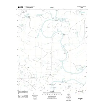
2011 Map of Mason Bend
USGS Topo · Published 2011About this map
Walden Quarters, Jackson Quarters, and Gilmore Quarters anchor this 2011 topographic landscape along the winding course of the Black Warrior River. This region of Alabama is defined by its deep relationship with the water, where the river carves out distinct geographical features like Mason Bend, Erie Bend, and Clements Bend. The presence of numerous landings, such as Millwood Landing and Lake Bend Landing, suggests a historical reliance on the river for transport and commerce, even as modern infrastructure like Co HWY 25 and Co HWY 41 provides terrestrial connections.
Find a feature on this map
78 named features on this map. Tap any name to fly to it.
Don’t see what you’re looking for? This feature index may not catch every label — zoom into the map to look around manually.
Map Details
Editions of this 2011 Mason Bend Map
This is the sole edition of this map. No revisions or reprints were ever made.
Other maps of this area

1927 · Eutaw
USGS Topo · 1:48,000

1931 · Eutaw
USGS Topo · 1:62,500

1946 · Demopolis
USGS Topo · 1:24,000

1947 · Demopolis
USGS Topo · 1:24,000

1947 · Mason Bend
USGS Topo · 1:24,000

1947 · Forkland
USGS Topo · 1:24,000

1948 · Mason Bend
USGS Topo · 1:24,000

1948 · Mc Dowell
USGS Topo · 1:24,000

1949 · Mc Dowell
USGS Topo · 1:24,000

1949 · Forkland
USGS Topo · 1:24,000