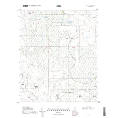
2020 Map of Mason Bend
USGS Topo · Published 2020About this map
Forkland sits atop the higher ground between the Black Warrior and Tombigbee river systems, anchoring a landscape defined by dramatic river bends and expansive bottomlands. The serpentine path of the river carves out distinct landforms like Erie Bend and Mason Bend, where steep embankments such as McAlpines Bluff and Wolf Bluff overlook the water. This terrain is characterized by a complex network of wetlands and sloughs, including the vast Dollarhide Swamp and Harkum Slough, which dominate the northern and central sections of the quadrangle.
Find a feature on this map
82 named features on this map. Tap any name to fly to it.
Don’t see what you’re looking for? This feature index may not catch every label — zoom into the map to look around manually.
Map Details
Editions of this 2020 Mason Bend Map
This is the sole edition of this map. No revisions or reprints were ever made.
Other maps of this area

1927 · Eutaw
USGS Topo · 1:48,000

1931 · Eutaw
USGS Topo · 1:62,500

1946 · Demopolis
USGS Topo · 1:24,000

1947 · Demopolis
USGS Topo · 1:24,000

1947 · Mason Bend
USGS Topo · 1:24,000

1947 · Forkland
USGS Topo · 1:24,000

1948 · Mason Bend
USGS Topo · 1:24,000

1948 · Mc Dowell
USGS Topo · 1:24,000

1949 · Mc Dowell
USGS Topo · 1:24,000

1949 · Forkland
USGS Topo · 1:24,000