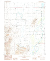
1987 Map of Mason Butte
USGS Topo · Published 1987About this map
The Singatse Range and its high-desert mining landscape dominate the western portion of this Lyon County survey. Extensive mineral extraction is evident through numerous prospect sites and established operations like the Stair Mine and Guild Placer Mines. The transition from the steep industrial terrain of Carson Hill and McLeod Hill to the agricultural flats of Mason Valley is marked by a complex network of irrigation, including the West Campbell Ditch and the Spragg - Alcorn - Bewley Ditch. Near the southern edge, the town of Yerington is depicted with its Municipal Airport and local landmarks like the Drive-In Theater. Large-scale water management is a primary theme, with a massive tailings pond and sewage disposal ponds situated between the hills and the valley floor.
Find a feature on this map
33 named features on this map. Tap any name to fly to it.
Don’t see what you’re looking for? This feature index may not catch every label — zoom into the map to look around manually.
Map Details
Editions of this 1987 Mason Butte Map
2 editions found
Other maps of this area

1891 · Wabuska
USGS Topo · 1:125,000

1891 · Wellington
USGS Topo · 1:125,000

1893 · Wellington
USGS Topo · 1:125,000

1894 · Wabuska
USGS Topo · 1:125,000

1948 · Walker Lake
USGS Topo · 1:250,000

1957 · Walker Lake
USGS Topo · 1:250,000

1957 · Wellington
USGS Topo · 1:62,500

1957 · Como
USGS Topo · 1:62,500

1957 · Wabuska
USGS Topo · 1:62,500

1957 · Yerington
USGS Topo · 1:62,500