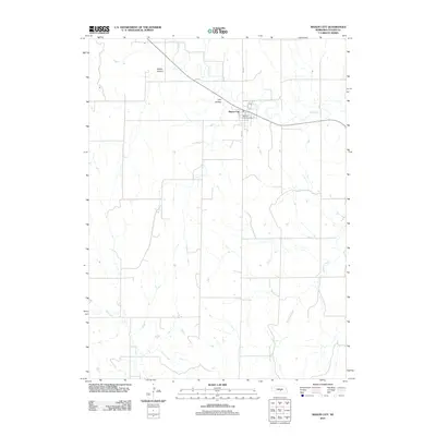
2011 Map of Mason City
USGS Topo · Published 2011About this map
Mason City serves as the primary hub of this Custer County landscape, situated where Mud Creek winds through the northern terrain. The village is organized around Main St, anchored by the Mason City Post Office, while the surrounding geography is defined by a series of drainages and named depressions. This 2011 survey captures the rural character of the region, where the prairie is punctuated by features like Happy Hollow and Lazy Hollow to the west. In the southern portion of the sheet, the hydrological network becomes more complex with the presence of Elk Creek and Stoddard Creek, illustrating the natural irrigation patterns that support this central Nebraska agricultural area. The map provides a clear record of the section-line road grid that characterizes the Great Plains settlement pattern.
Find a feature on this map
8 named features on this map. Tap any name to fly to it.
Don’t see what you’re looking for? This feature index may not catch every label — zoom into the map to look around manually.
Map Details
Editions of this 2011 Mason City Map
This is the sole edition of this map. No revisions or reprints were ever made.
Other maps of this area

1951 · Ansley
USGS Topo · 1:24,000

1951 · Litchfield SW
USGS Topo · 1:24,000

1951 · Mason City SW
USGS Topo · 1:24,000

1951 · Mason City NW
USGS Topo · 1:24,000

1951 · Mason City
USGS Topo · 1:24,000

1951 · Ansley SE
USGS Topo · 1:24,000

1951 · Mason City SE
USGS Topo · 1:24,000

1951 · Arcadia SW
USGS Topo · 1:24,000

1951 · Litchfield
USGS Topo · 1:24,000

1955 · Broken Bow
USGS Topo · 1:250,000