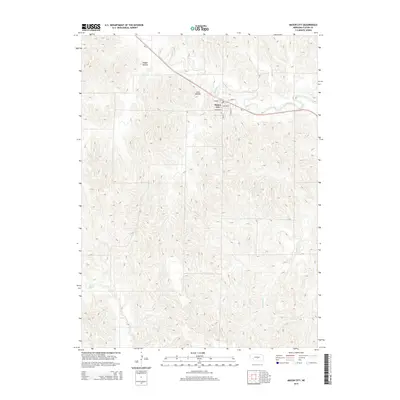
2014 Map of Mason City
USGS Topo · Published 2014About this map
Mason City serves as the central hub of this Nebraska landscape, situated along the diagonal path of Ne-2 and the winding course of Mud Cr. The village layout is clearly defined by its street grid, including Main St, Fremont St, and Calhoun St, which anchor the settlement amidst a series of dramatic topographical depressions. These geographical features, such as Happy Hollow and Lazy Hollow, illustrate the dissected nature of the Custer County terrain where small drainages like Stoddard Cr and Elk Cr have carved through the plains. The proximity of the town to these hollows and creeks suggests a settlement pattern deeply influenced by the availability of water and the natural shelter provided by the undulating hillsides.
Find a feature on this map
13 named features on this map. Tap any name to fly to it.
Don’t see what you’re looking for? This feature index may not catch every label — zoom into the map to look around manually.
Map Details
Editions of this 2014 Mason City Map
This is the sole edition of this map. No revisions or reprints were ever made.
Other maps of this area

1951 · Ansley
USGS Topo · 1:24,000

1951 · Litchfield SW
USGS Topo · 1:24,000

1951 · Mason City SW
USGS Topo · 1:24,000

1951 · Mason City NW
USGS Topo · 1:24,000

1951 · Mason City
USGS Topo · 1:24,000

1951 · Ansley SE
USGS Topo · 1:24,000

1951 · Mason City SE
USGS Topo · 1:24,000

1951 · Arcadia SW
USGS Topo · 1:24,000

1951 · Litchfield
USGS Topo · 1:24,000

1955 · Broken Bow
USGS Topo · 1:250,000