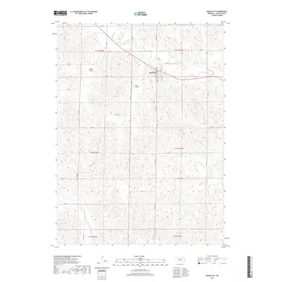
2017 Map of Mason City
USGS Topo · Published 2017About this map
Mason City sits at the intersection of a grid-style township system in central Nebraska, where the local terrain is defined by a series of drainage basins and valleys. The settlement is organized around a small core of streets including Main St and Clinton St, serving as a focal point for the surrounding agricultural landscape. The township structure is clearly delineated by the presence of t15n r18w and t14n r17w boundaries, which dictate the placement of local thoroughfares like RD 787 and S Mason Rd.
Find a feature on this map
35 named features on this map. Tap any name to fly to it.
Don’t see what you’re looking for? This feature index may not catch every label — zoom into the map to look around manually.
Map Details
Editions of this 2017 Mason City Map
This is the sole edition of this map. No revisions or reprints were ever made.
Other maps of this area

1951 · Ansley
USGS Topo · 1:24,000

1951 · Litchfield SW
USGS Topo · 1:24,000

1951 · Mason City SW
USGS Topo · 1:24,000

1951 · Mason City NW
USGS Topo · 1:24,000

1951 · Mason City
USGS Topo · 1:24,000

1951 · Ansley SE
USGS Topo · 1:24,000

1951 · Mason City SE
USGS Topo · 1:24,000

1951 · Arcadia SW
USGS Topo · 1:24,000

1951 · Litchfield
USGS Topo · 1:24,000

1955 · Broken Bow
USGS Topo · 1:250,000