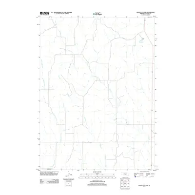
2011 Map of Mason City NW
USGS Topo · Published 2011About this map
Elk Creek and its various tributaries define the drainage patterns of this central Nebraska landscape, which is largely characterized by an organized grid of section lines and rural roadways. The northeast corner of the quadrangle is anchored by the Knapp Dam and its corresponding Knapp Reservoir, providing a focal point for water management in an area dominated by agricultural land divisions. Other watercourses, including Cat Creek and East Box Elder Creek, flow through the terrain, illustrating the natural watershed that local farmers and residents have navigated for generations. The inclusion of Cumro Rd highlights the sparse but essential transportation network connecting isolated farmsteads across Custer County. This survey reflects the modern rural infrastructure as it stood in the early 21st century, showing how the natural hydrology and human-imposed land grids coexist.
Find a feature on this map
6 named features on this map. Tap any name to fly to it.
Don’t see what you’re looking for? This feature index may not catch every label — zoom into the map to look around manually.
Map Details
Editions of this 2011 Mason City NW Map
This is the sole edition of this map. No revisions or reprints were ever made.
Other maps of this area

1951 · Ansley
USGS Topo · 1:24,000

1951 · Broken Bow SE
USGS Topo · 1:24,000

1951 · Eddyville NE
USGS Topo · 1:24,000

1951 · Mason City SW
USGS Topo · 1:24,000

1951 · Eddyville
USGS Topo · 1:24,000

1951 · Mason City NW
USGS Topo · 1:24,000

1951 · Mason City
USGS Topo · 1:24,000

1951 · Ansley SE
USGS Topo · 1:24,000

1951 · Mason City SE
USGS Topo · 1:24,000

1955 · Broken Bow
USGS Topo · 1:250,000