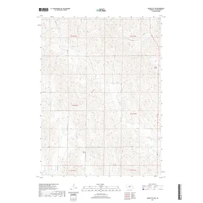
2017 Map of Mason City NW
USGS Topo · Published 2017About this map
Flat Bottom and the surrounding loess hills of Custer County dominate this landscape, showing the drainage patterns of the Central Platte Valley. The terrain is defined by a dense network of intermittent and perennial streams, including the eastern and western branches of E Box Elder Cr and W Box Elder Cr, which carve through the high plains. Human activity is marked by a precise grid of sectional roads like Box Elder Rd and Cumro Rd, reflecting the enduring legacy of the Public Land Survey System in Nebraska's ranching and farming country.
Find a feature on this map
31 named features on this map. Tap any name to fly to it.
Don’t see what you’re looking for? This feature index may not catch every label — zoom into the map to look around manually.
Map Details
Editions of this 2017 Mason City NW Map
This is the sole edition of this map. No revisions or reprints were ever made.
Other maps of this area

1951 · Ansley
USGS Topo · 1:24,000

1951 · Broken Bow SE
USGS Topo · 1:24,000

1951 · Eddyville NE
USGS Topo · 1:24,000

1951 · Mason City SW
USGS Topo · 1:24,000

1951 · Eddyville
USGS Topo · 1:24,000

1951 · Mason City NW
USGS Topo · 1:24,000

1951 · Mason City
USGS Topo · 1:24,000

1951 · Ansley SE
USGS Topo · 1:24,000

1951 · Mason City SE
USGS Topo · 1:24,000

1955 · Broken Bow
USGS Topo · 1:250,000