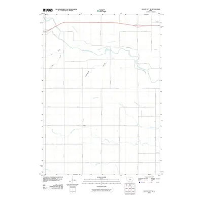
2010 Map of Mason City SE
USGS Topo · Published 2010About this map
The Winnebago River meanders through the heart of this Cerro Gordo County landscape, defining the hydrology of a region just southeast of Mason City. The settlement of Owen sits near the confluence of several vital waterways, including the winding Beaver Creek and Rock Creek. The terrain is marked by distinctive geological features such as the Big Gully and an area labeled simply as Badlands, which contrast with the orderly grid of county roads and the modern thoroughfare known as the Ave of the Saints. This 2010 survey reveals a rural infrastructure where historical creek names like Little Lime Creek and Coldwater Creek persist alongside a sprawling network of numbered and bird-named avenues, illustrating the intersection of old Iowa watercourses with contemporary transportation planning.
Find a feature on this map
35 named features on this map. Tap any name to fly to it.
Don’t see what you’re looking for? This feature index may not catch every label — zoom into the map to look around manually.
Map Details
Editions of this 2010 Mason City SE Map
This is the sole edition of this map. No revisions or reprints were ever made.
Other maps of this area

1954 · Mason City
USGS Topo · 1:250,000

1954 · Waterloo
USGS Topo · 1:250,000

1955 · Waterloo
USGS Topo · 1:250,000

1957 · Mason City
USGS Topo · 1:250,000

1958 · Mason City
USGS Topo · 1:250,000

1959 · Mason City
USGS Topo · 1:24,000

1959 · Mason City
USGS Topo · 1:62,500

1959 · Nora Springs
USGS Topo · 1:24,000

1959 · Mason City SE
USGS Topo · 1:24,000

1959 · Hanford
USGS Topo · 1:24,000