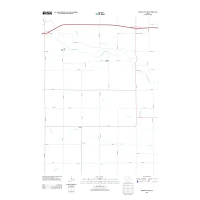
2013 Map of Mason City SE
USGS Topo · Published 2013About this map
The Winnebago River meanders across the northern portion of this Cerro Gordo County landscape, flanked by distinctive terrain features such as Little Gully, Big Gully, and Badlands Draw. The rural character of the region is defined by a grid of local roads and the major transit artery known as the Avenue of the Saints. Central to the map is the settlement of Owen, situated at the intersection of 190th St and Vine Ave.
Find a feature on this map
39 named features on this map. Tap any name to fly to it.
Don’t see what you’re looking for? This feature index may not catch every label — zoom into the map to look around manually.
Map Details
Editions of this 2013 Mason City SE Map
This is the sole edition of this map. No revisions or reprints were ever made.
Other maps of this area

1954 · Mason City
USGS Topo · 1:250,000

1954 · Waterloo
USGS Topo · 1:250,000

1955 · Waterloo
USGS Topo · 1:250,000

1957 · Mason City
USGS Topo · 1:250,000

1958 · Mason City
USGS Topo · 1:250,000

1959 · Mason City
USGS Topo · 1:24,000

1959 · Mason City
USGS Topo · 1:62,500

1959 · Nora Springs
USGS Topo · 1:24,000

1959 · Mason City SE
USGS Topo · 1:24,000

1959 · Hanford
USGS Topo · 1:24,000