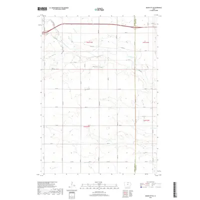
2018 Map of Mason City SE
USGS Topo · Published 2018About this map
Owen's Grove Cem sits in the northwest corner of this rural Cerro Gordo County landscape, serving as a primary point of interest for genealogists tracing family histories in the region. The area is defined by its complex drainage network, where the Winnebago River and several of its tributaries, including Little Lime Cr, Rock Cr, and Beaver Cr, weave through the sectioned agricultural fields. Distinctive landforms such as Badlands Draw, Big Gully, and Little Gully provide a detailed look at the local topography and erosion patterns that have shaped this Iowa farmland. The map also records the precise grid of county roads and avenues, including Claybanks DR and Co HWY 570, which established the modern transport patterns across the townships of T96N R19W and T95N R18W.
Find a feature on this map
77 named features on this map. Tap any name to fly to it.
Don’t see what you’re looking for? This feature index may not catch every label — zoom into the map to look around manually.
Map Details
Editions of this 2018 Mason City SE Map
This is the sole edition of this map. No revisions or reprints were ever made.
Other maps of this area

1954 · Mason City
USGS Topo · 1:250,000

1954 · Waterloo
USGS Topo · 1:250,000

1955 · Waterloo
USGS Topo · 1:250,000

1957 · Mason City
USGS Topo · 1:250,000

1958 · Mason City
USGS Topo · 1:250,000

1959 · Mason City
USGS Topo · 1:24,000

1959 · Mason City
USGS Topo · 1:62,500

1959 · Nora Springs
USGS Topo · 1:24,000

1959 · Mason City SE
USGS Topo · 1:24,000

1959 · Hanford
USGS Topo · 1:24,000